Tennessee Land Expert
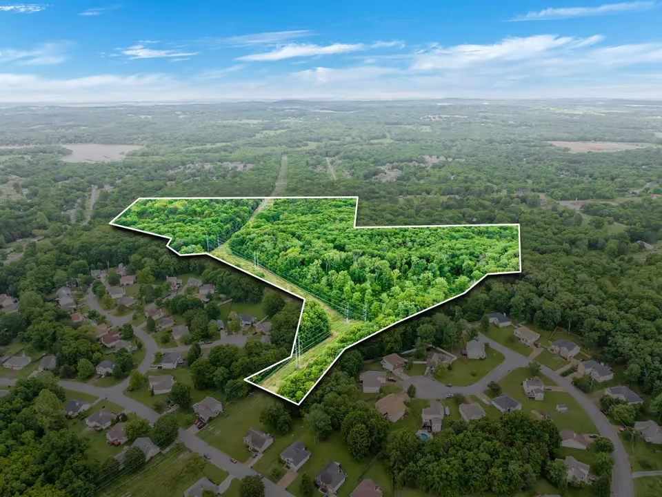
Buying Development Land Near Nashville
Nashville's growth isn't slowing down, and the development pressure is moving outward. Williamson, Rutherford, and Davidson Counties are seeing demand for residential and mixed-use development that didn't exist at this level five years ago. For builders and investors, that creates opportunity — but only if you know how to evaluate raw land through a development lens rather than a residential one.
Most agents showing land to developers are pulling acreage listings off the MLS and hoping the numbers work. They're not evaluating soil composition, stormwater management requirements, utility proximity, or the zoning trajectory of the surrounding parcels. That gap between what's listed and what's actually buildable is where deals fall apart — or where informed buyers find value that everyone else misses.
Here's what I look at when a builder or investor asks me to evaluate development land in the Nashville growth corridor.
Zoning Is the Starting Point, Not the Answer
Every developer checks zoning first. That's table stakes. But current zoning only tells you what's permitted today — it doesn't tell you what's likely to be approved tomorrow, or what the county's comprehensive plan signals about the future of that area.
In fast-growing counties like Williamson and Rutherford, zoning changes are happening regularly as municipalities respond to population pressure. A parcel zoned agricultural today may sit directly in the path of a planned sewer extension or a road widening project that makes rezoning far more likely within a 12- to 24-month window. Conversely, a parcel that looks like an obvious development play may face community pushback or conservation overlay restrictions that make rezoning a long and uncertain process.
I track planning commission agendas, comprehensive plan updates, and infrastructure investment patterns across the counties I serve. When I tell a builder a parcel has rezoning potential, it's because I've done the homework on what the county is signaling — not because the listing description says "great development potential."
Utilities Determine Feasibility
A 50-acre tract with the right zoning and strong road frontage still isn't a development site if water and sewer are two miles away. Utility extension costs can break a deal that looks profitable on paper.
Before I recommend a property to a development client, I'm mapping the nearest water and sewer tap points, evaluating the capacity of the existing system to handle additional connections, and determining whether the municipality or utility district has planned extensions that would serve the parcel. In areas outside sewer districts, I'm looking at soil suitability for septic — which ties directly to the density a builder can achieve.
This is especially relevant in southern Williamson County and eastern Rutherford County, where you'll find large tracts at attractive per-acre pricing but with utility infrastructure that hasn't caught up to the demand. The land looks ready. The infrastructure may not be.
Topography Dictates Density
Flat land develops differently than rolling land, and rolling land develops differently than anything with significant grade changes. Topography affects lot layout, stormwater management, road engineering, and ultimately the number of units or lots a builder can achieve on a given parcel.
My background in biology means I read terrain differently than most agents. I'm evaluating drainage patterns, identifying natural drainage corridors that will become stormwater easements, assessing flood risk from creek systems that may not appear on standard flood maps, and understanding how soil types interact with slope to affect buildability.
A developer looking at a 30-acre site in Rutherford County needs to know whether they're getting 30 buildable acres or 22 buildable acres with 8 acres of drainage infrastructure and steep-slope setbacks. That distinction is the difference between a project that pencils and one that doesn't.
Road Frontage and Access Shape Everything
Access isn't just about having a curb cut. It's about the road classification, traffic counts, the county or TDOT's requirements for turn lanes or deceleration lanes, and whether the road network can support the additional traffic a development generates.
A parcel on a state route may require TDOT permitting for access, which adds time and cost. A parcel on a county road may face different improvement requirements depending on the projected traffic impact. In some cases, a property's best development access isn't from the existing road frontage at all — it's through an adjacent parcel that would need to be acquired or an easement that would need to be negotiated.
I evaluate access holistically because it's one of the first things a planning department will scrutinize during the approval process. If the access story is weak, the project timeline gets longer and more expensive — regardless of how good the land itself looks.
Understand the Competitive Landscape
Development land doesn't exist in a vacuum. If you're looking at a 40-acre residential tract in a growth corridor, you need to know what else is already permitted, under construction, or in the pipeline within a reasonable radius. Overbuilding in a submarket drives down lot premiums and absorption rates.
I monitor active developments, pending permits, and land transactions across the counties I work in. When I bring a development opportunity to a client, I can speak to what the competitive landscape looks like — how many lots are currently being absorbed annually in that area, what price points are moving, and whether the submarket can support additional inventory.
This isn't data you find on a listing sheet. It comes from being embedded in the market and tracking it consistently.
Soil and Environmental Due Diligence
For residential subdivision development, soil testing determines septic feasibility (outside sewer districts) and foundation requirements. For any development, a Phase I Environmental Site Assessment may be warranted depending on the property's history.
I look at soil survey data early in the evaluation process because it flags potential issues before a developer spends money on engineering. Properties with karst geology — common in parts of Middle Tennessee — may have sinkhole risk that affects site planning. Properties with hydric soils may have wetland delineation requirements that restrict buildable area.
These aren't deal-killers in most cases, but they are cost variables that need to show up in the proforma before an offer goes in, not after.
What This Means for Your Next Acquisition
The Nashville growth corridor still has strong fundamentals for development — population growth, job creation, infrastructure investment, and relative affordability compared to peer markets. But the easy sites are gone. What's left requires more evaluation, more local knowledge, and more nuance to underwrite correctly.
That's exactly where I operate. My approach to development land combines scientific land evaluation with real-time market knowledge across Williamson, Davidson, and Rutherford Counties. I'm not just showing you acreage — I'm helping you determine whether that acreage becomes a viable project.
If you're actively looking for development land in the Nashville suburbs or evaluating a tract you've already identified, I'd welcome that conversation.
[Contact Paul →]
More Tennessee Land Resources

What Clients Say
Let's talk about your land
Whether you're buying your first recreational tract or selling generations of family land — Paul picks up the phone. No intake forms. No scheduling links. Just a direct conversation.